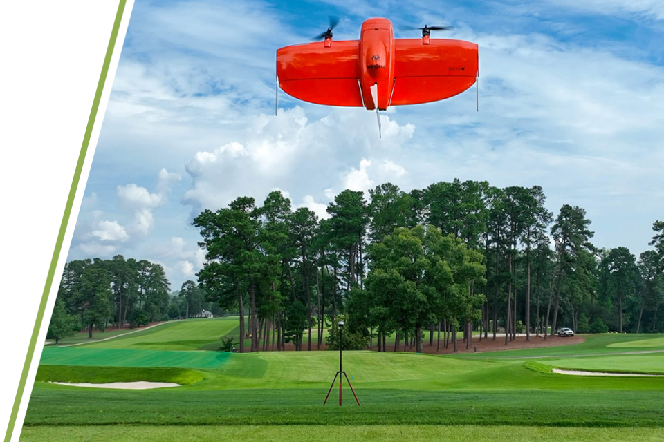
We lead the industry in cutting-edge course mapping services, providing unparalleled insights. Utilizing airborne and terrestrial technologies, we produce world-class data sets suitable for a wide range of land development and management applications.
Our FAA-certified drone operators develop and execute a flight path over client properties using a multirotor or fixed-wing drone. These specially designed drones use a combination of GPS and prescribed onboard sensors to create a high-resolution aerial image and a hyper-accurate surface model of the property. We use 3D laser scanners that yield sub-centimeter accuracy for areas demanding heightened levels of precision.
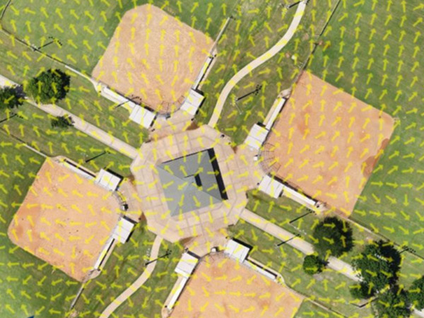
Easily click on any feature, above or below ground to gain a detailed list of attributes including measurements, distributor, type/variety, and even maintenance records.
Course Renovations
M4 simplifies project planning by providing architects with accurate, real-time topographical data and infrastructure layouts.
Operational Efficiency
Enables course managers to optimize irrigation, drainage, and landscaping workflows.
Enhanced Visualization
Delivers visually compelling presentations for stakeholders, aiding in approvals and investor relations.