M4 FieldView

Revolutionizing Total Property Management

The industry’s leading SaaS platform for transforming construction data and as-built documentation into interactive digital assets.

Map, Measure, Model, Manage

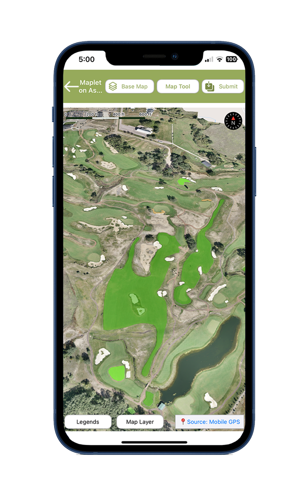
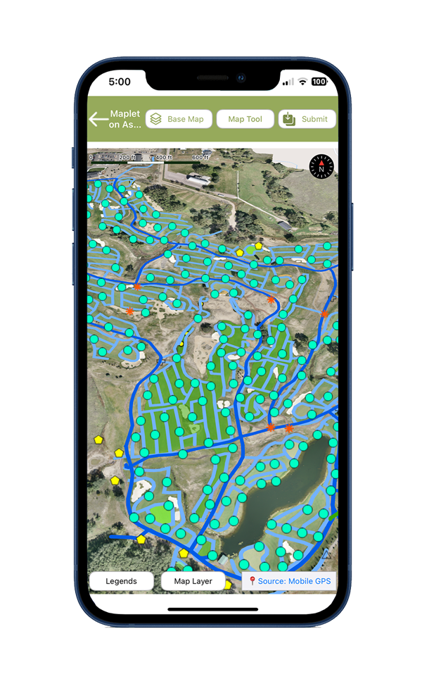
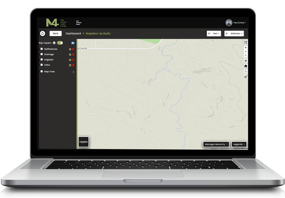
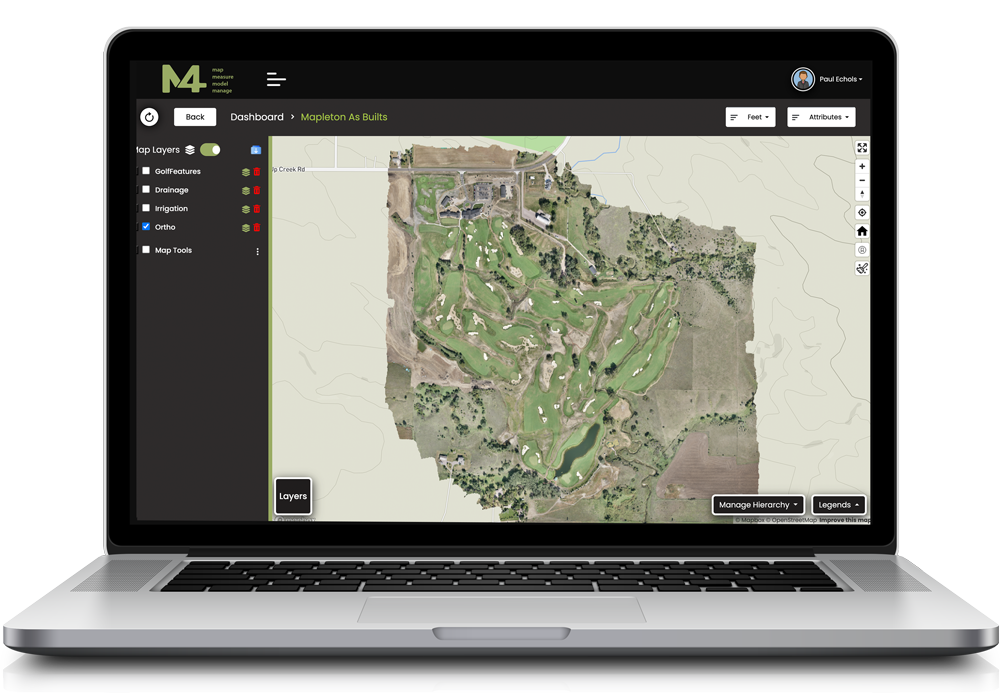
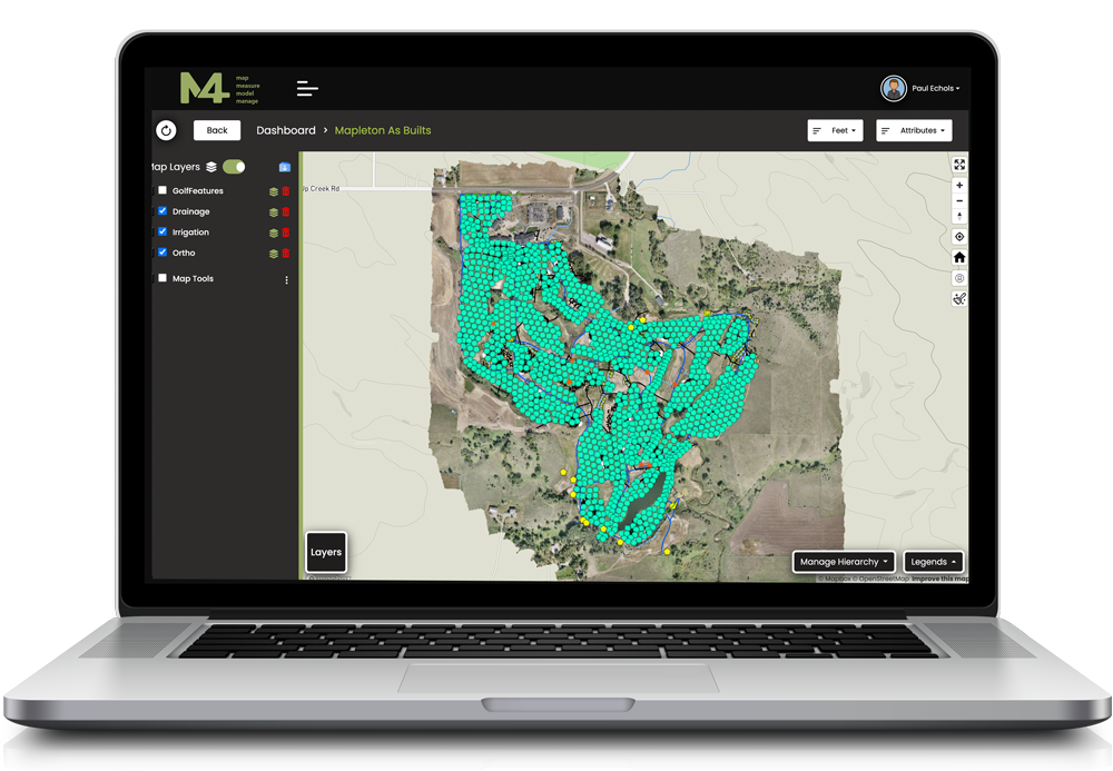
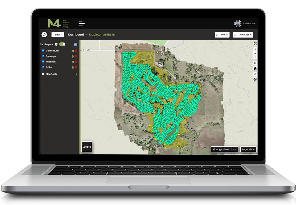
M4 is the ultimate solution for property management, leveraging advanced technologies to deliver high-resolution surface maps and survey grade as-built data of features and buried infrastructure. M4 transforms traditional as-built documentation by converting static data into dynamic, easy-to-navigate tools.

  • Map – Harness the power of aerial and terrestrial surveys to captures millions of data points processed through a suite of geospatial software to produce survey-grade deliverables.
  • Measure – 
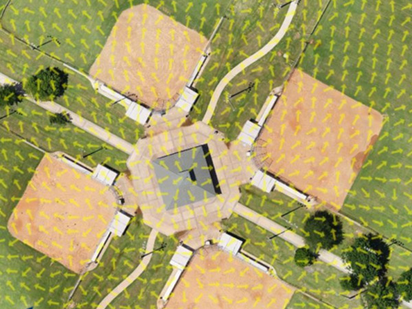
Analyze three-dimensional surface areas, material volumes, slopes, infrastructure locations, watershed/flowlines, and plant health with precision.
  • Model – Derive actionable insights to inform capital planning and operational strategies.
  • Manage – Visualize and control your property like never before, elevating management efficiency and effectiveness.
Course mapping

Why Choose M4

M4 FieldView isn’t just a tool; it is a game-changer. By combining modern geospatial technology with intuitive digital interfaces, M4 simplifies complicated property management challenges, saving time, cutting costs, and promoting operational excellence. Whether you’re managing one property or an entire portfolio, M4 offers the clarity, control, and confidence to make informed decisions effortlessly.

Choose M4 to:

  • Locate and interact with physical assets, including buried infrastructure with ease.
  • Make better-informed decisions driven by data.
  • Ensure your design remains functional and sustainable.
  • Improve collaboration between multiple teams working on your property.
  • Reduce risk by identifying possible issues before they become problems.
  • Minimize waste and prevent unnecessary expenses.

M4 Capabilities & Features

M4 FieldView is set to transform the way property managers, master planners, and architects visualize, analyze, and manage their assets.

High-Resolution Mapping

Using advanced data collection methods like GPS, LiDAR, photogrammetry, and bathymetry, M4 provides unmatched precision and clarity, enabling better decision-making.

Buried Infrastructure Visualization

See beyond the surface with detailed mapping of irrigation, drainage, and any underground utilities and systems, giving you a complete picture of your property.

High-Resolution Mapping

Using advanced data collection methods like GPS, LiDAR, photogrammetry, and bathymetry, M4 provides unmatched precision and clarity, enabling better decision-making.

Tailored For Diverse Properties

Including but not limited to golf courses, institutions, resorts, municipalities, and master planned communities, all while keeping the operators in mind.  M4 enhances the ability to maintain, plan, and innovate across every aspect of property management.

How M4 Works

Learn More About M4

Are you ready to streamline operations, enhance decision-making, and drive sustainable growth? Complete the form to learn more about M4 FieldView.

This field is for validation purposes and should be left unchanged.